
Civil Site Plan: What Goes in a Permit-Ready Set in North Texas
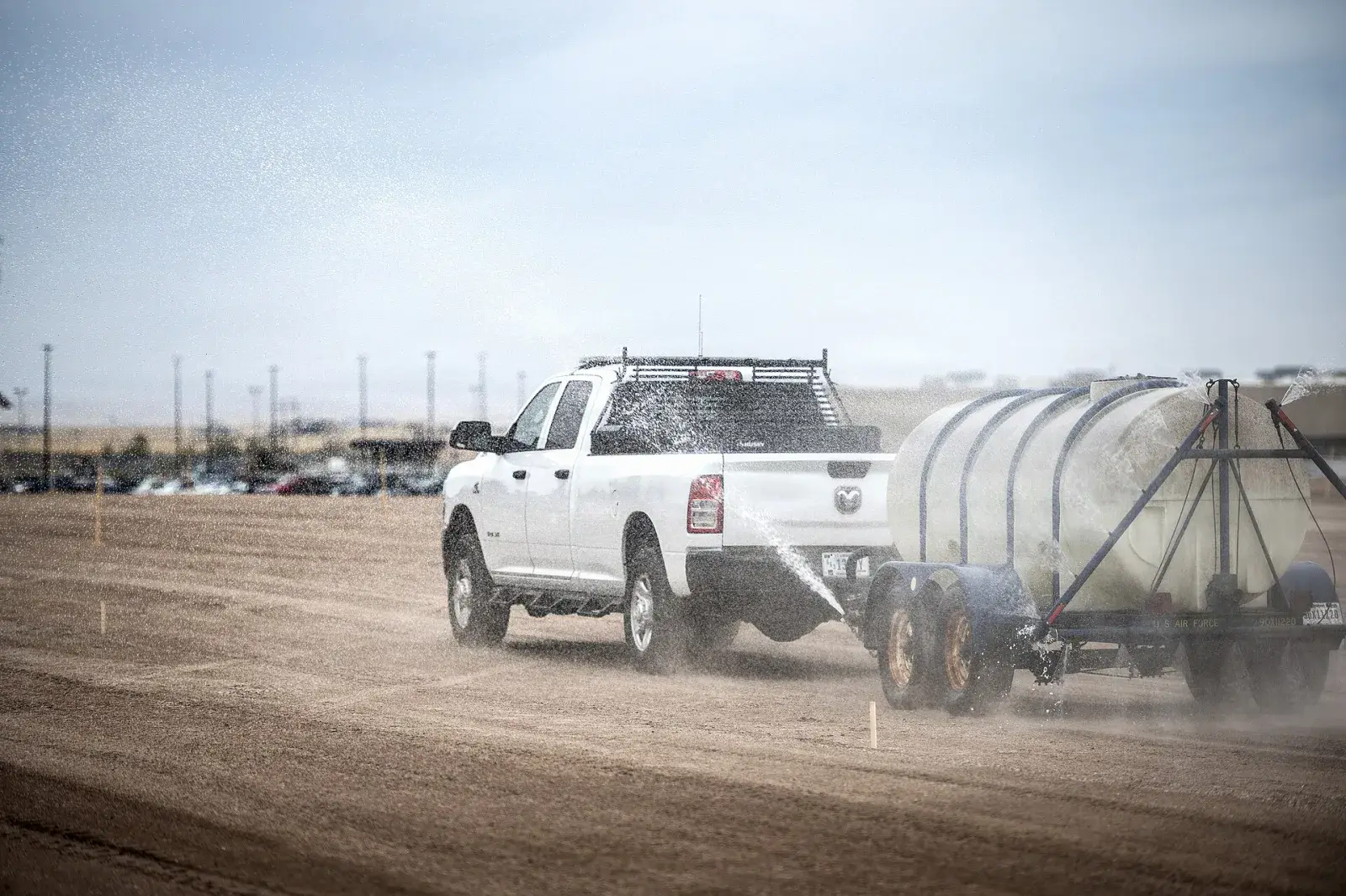
Grading and paving sheets in a civil site plan set turn into work like this: subgrade preparation for a new parking area. (Photo: U.S. Space Force photo by Dennis Rogers · Public domain (US gov))

A civil site plan is the set of engineering drawings that shows how a piece of land will be built out. It covers where the building and pavement go, how the ground is graded, where stormwater goes, how water, sewer and storm lines connect, how fire trucks get in, and how the site is protected from erosion during construction. A "permit-ready" set is one the city can review and approve without sending it back for missing pieces. In North Texas that means a multi-sheet set sealed by a professional engineer, built around the city's checklist and the regional stormwater criteria.
What sheets are in a civil site plan set?
Every city has its own checklist, and it pays to download it before design starts. The City of Denton's Civil Engineering Plans Checklist is a good example of what a North Texas city expects. It calls for 24" x 36" sheets "sealed by the engineer of record" and a defined sheet order:
| Sheet (Denton numbering) | What it shows | What reviewers check first |
|---|---|---|
| C1.01 Cover | Project name, location map, sheet index, engineer's seal | Correct legal description and plat reference |
| C2.01 General notes | City standard notes, contractor responsibilities | Current city notes, not an old template |
| C4.01 Plat | The recorded or proposed plat | Easements and lot lines match the site layout |
| C5.01 Existing conditions / demolition | Survey, existing utilities, trees, structures to be removed | Utilities located and capped correctly |
| C6.01 Site (zoning compliance) plan | Building footprint, parking, setbacks, landscape areas | Zoning setbacks, parking counts |
| C7.01 Dimensional control | Dimensions and coordinates for layout | Fire-lane widths and radii |
| C8.01 Drainage area maps | Existing and proposed drainage areas and flows | Runoff calculations, offsite flow |
| C9.01 Grading | Spot elevations, contours, finished floor | Slopes, ADA routes, overland relief |
| C9.60 Detention | Pond grading, outlet structure, routing | Release rates vs. pre-development |
| C10–C13 Utility, storm, water, sanitary sewer | Plan and profile for each system | Separations, tie-ins, fire hydrant coverage |
| C14 Paving | Pavement sections, joints, curb and gutter | Section matches the geotechnical report |
| C15 Signage and striping | Fire-lane striping, ADA signage | Fire-lane marking per local code |
| C16.01 Erosion control | Silt fence, inlet protection, construction entrance | Matches the SWPPP |
| C17.01 Standard details | City and project details | Current city details |
Landscape, solid waste and tree preservation sheets are often required alongside the civil set. Other cities number sheets differently but ask for much the same content.
The North Texas rules behind most review comments
iSWM drainage criteria
Most DFW-area cities base their drainage rules on iSWM (integrated Stormwater Management), a regional program run by the North Central Texas Council of Governments (NCTCOG). It's aimed at "water quality protection, streambank protection, and flood mitigation." The iSWM Criteria Manual is written so cities "may use [it] as a component of their stormwater management related development regulations," and "the criteria may be customized by local governments." That last point matters. Denton, Frisco, Fort Worth, Celina, Plano, Irving, Lewisville and Arlington all take part in iSWM, but each city's version can differ. Always design to the city's adopted manual, not the regional default. Denton's checklist, for example, requires water quality volume to be calculated "per Integrated Stormwater Management (iSWM) methodologies."
TCEQ construction stormwater
Separately from the city's drainage review, the state's Construction General Permit, TXR150000, covers stormwater during construction. The City of Dallas summarizes the thresholds this way. Sites disturbing at least 1 acre but under 5 acres follow the small construction site rules: prepare and implement a stormwater pollution prevention plan (SWP3) and post a site notice. Sites of 5 acres or more follow the large site rules, which add a Notice of Intent filed with TCEQ. Under 1 acre, permit coverage generally isn't required unless the site is part of a larger common plan of development, though erosion controls still apply. The erosion control sheet in the civil set should match the SWP3. Reviewers notice when they don't. TCEQ reissues this permit periodically, so confirm current terms on the TCEQ site.
Fire access
The 2021 International Fire Code sets the baseline for fire apparatus access roads:
- At least 20 feet of unobstructed width and 13 feet 6 inches of vertical clearance (§503.2.1)
- Reaching within 150 feet of all portions of the first-story exterior walls (§503.1.1)
- A turnaround for dead ends longer than 150 feet (§503.2.5)
- All-weather driving surface (§503.2.3)
Appendix D, where a city adopts it, adds that the surface must carry apparatus up to 75,000 pounds, the road must be 26 feet wide where a hydrant sits on it, and grades are limited to 10 percent. Many cities go further. Denton's checklist calls for fire lanes "24' wide for buildings up to 30' in height" and 26 feet for taller buildings. That's wider than the IFC baseline. Fire-lane width is one of the most common resubmittal comments, so check the local fire code amendments before laying out parking.
Do site plans have a 30-day approval clock in Texas?
Plats do. Site plans generally no longer do. After House Bill 3699 took effect in 2023, the Texas Municipal League notes that "the term 'plans' has been completely removed from the Platting Subchapter, leaving only 'plats' subject to the shot clock." Before that, many cities processed site and construction plans on the same tight timelines. Review times for civil plans now depend on each city's process, so ask for the review calendar at the pre-application meeting. For the plat side, see our separate guide to platting in Texas.
How to shorten the comment-response loop
Most delays come from resubmittals, not from the first review. These habits cut the number of rounds:
- Hold a pre-application meeting. Confirm the drainage manual, fire-lane widths, utility tie-in points and any offsite improvements before design.
- Use the city's current checklist and notes. Old templates are an easy source of comments.
- Get the geotechnical report early. Pavement sections and detention pond side slopes should come from site-specific data. See our geotechnical services.
- Coordinate the plat and the site plan. Easements, lot lines and dedications have to match across both.
- Answer every comment in writing. List the sheet where each change was made, and cloud the revisions.
- Call the reviewer when a comment is unclear. A five-minute call can save a full review cycle.
What a civil site plan doesn't cover
A civil set doesn't replace the building's architectural and structural drawings. It also doesn't replace the boundary survey or the plat, which a Registered Professional Land Surveyor prepares. It's also separate from the TCEQ permit paperwork, though the civil engineer often prepares the SWP3 or the erosion control plan that supports it. Knowing who owns each piece keeps the schedule honest.
Getting a site plan started
Isbell Engineering Consultants prepares permit-ready civil construction documents, handles municipal and agency plan submittals, and coordinates plan review comments and revisions. That work sits alongside grading and drainage, detention, utility and paving design. See the civil engineering services page or the full service list. To discuss a site, send the survey, a concept layout and the city name through the contact page.
Frequently asked questions
What is a civil site plan?
It's the set of sealed engineering drawings showing how a site will be developed. It covers layout, grading, drainage, detention, utilities, paving, fire access and erosion control. Cities review it before issuing permits for site work.
What's the difference between a site plan and civil plans?
Cities use the terms differently. A "site plan" sometimes means a single zoning-level sheet showing building, parking and setbacks. "Civil plans" or "civil construction documents" means the full engineered set used for permitting and construction.
Who prepares a civil site plan in Texas?
A licensed professional engineer prepares and seals the engineering sheets. The boundary and topographic survey and the plat come from a Registered Professional Land Surveyor.
How long does site plan approval take in North Texas?
It varies by city and by how many review rounds the plans need. Plats have a statutory 30-day decision period. Since HB 3699 (2023), site plans are no longer covered by that platting clock, so ask the city for its review calendar.
Do I need a SWPPP for a small commercial site?
Under TXR150000, sites disturbing 1 acre or more need coverage. Sites of 1 to 5 acres follow the small-site rules: prepare an SWP3 and post a notice. Sites of 5 acres or more also file a Notice of Intent with TCEQ. Smaller sites that are part of a larger common plan can still be covered.
Sources
- NCTCOG, What is iSWM
- NCTCOG iSWM Criteria Manual
- City of Denton, Civil Engineering Plans Checklist
- City of Dallas, Construction stormwater (TXR150000 small and large sites)
- TCEQ presentation, The Stormwater Construction General Permit TXR150000
- 2021 International Fire Code, Chapter 5 Fire Service Features (§503)
- 2021 IFC Appendix D, Fire Apparatus Access Roads
- Texas Municipal League, Platting Shot Clock Process Q&A (Nov 2023)
Image credits
- Water truck moisture-conditioning soil on a graded parking lot site before compaction. Photo: U.S. Space Force photo by Dennis Rogers · Public domain (US gov)
Related articles
Copyright © 2026 Isbell Engineering Consultants - All Rights Reserved.
Made & Managed by North Texas Business Solutions