
How to Read a Geotechnical Report (Section by Section)
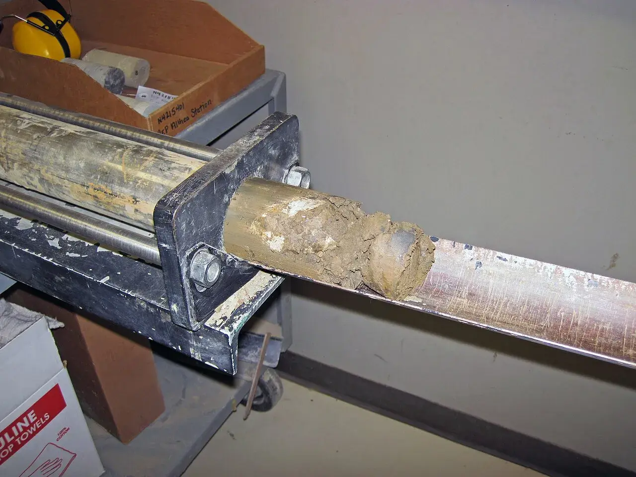
A thin-walled tube sample being extruded in the lab. Strength and swell results on a boring log usually come from samples like this one. (Photo: James St. John, via Wikimedia Commons (CC BY 2.0) · CC BY 2.0 · cropped and resized)

A geotechnical report tells your design team what's under the site and what to build on it: the soil and rock layers, the groundwater, and recommendations for foundations, slabs, pavements and earthwork. You don't need to check the engineer's math. You do need to know where the key numbers are, what the boring logs show and what assumptions the recommendations rest on. If those assumptions don't match your project, the report won't fit it either.
What a geotechnical report is, and who it's written for
The report is written by a geotechnical engineer for a specific project, site and client. Under 2021 IBC §1803.1, an investigation that involves in-situ testing, lab testing or engineering calculations has to be done by a registered design professional.
Some reports are split in two. A factual (data) report gives the boring logs and test results. An interpretive report adds the analysis and recommendations. Many commercial reports combine both in one document, with logs and lab data in the appendices.
Many reports also include a cover sheet from the Geoprofessional Business Association titled Important Information about This Geotechnical-Engineering Report. Owners tend to skip it. Read it. It explains that the report was prepared for a specific client and project, that it should be read in full, that the logs shouldn't be redrawn or separated from the report, and that the recommendations depend on the engineer confirming conditions during construction.
The sections, in the order you'll usually find them
| Section | What's in it | What to check |
|---|---|---|
| Project description | Building type, size, loads, finished floor, grading assumptions | Does it match your current plans? If the building moved, grew or the floor elevation changed, call the engineer. |
| Site and geology | Site history, surface conditions, mapped geology | Mentions of old fill, ponds, trees or prior structures |
| Field exploration | Number and depth of borings, drilling and sampling methods, a boring location plan | Are borings inside the building footprint and in paved areas? |
| Laboratory testing | List of tests run on samples | Swell and plasticity tests on clay sites, strength tests where piers or footings bear |
| Subsurface conditions | Generalized soil profile, rock depth, groundwater | How uniform the site is. Look for layers that change between borings. |
| Expansive soil evaluation | PVR or other movement estimate, active zone depth | The movement number your slab design must handle |
| Foundation recommendations | Foundation type, bearing pressure, pier depths and capacities, settlement | Options and their tradeoffs. Some reports give more than one. |
| Floor slab recommendations | Slab support, moisture conditioning or select fill thickness, vapor retarder notes | What earthwork the slab depends on |
| Pavement recommendations | Subgrade treatment, pavement sections for light and heavy traffic | Truck traffic assumptions match how you'll use the lot |
| Retaining wall parameters | Earth pressures, soil unit weights, friction values | Only included if walls were in the scope |
| Earthwork | Site preparation, fill materials, compaction and moisture specs, testing | This section becomes part of your specifications |
| Construction considerations | Groundwater, excavation stability, pier drilling issues, weather | Items that drive contractor pricing |
| Limitations | Scope limits, variability between borings, need for construction observation | What the report does not cover |
| Appendices | Boring location plan, boring logs, lab results, key to symbols | Where the raw data lives |
IBC §1803.6 lists the minimum contents for a report where one is required: a plot of boring locations, boring logs and test results, a soil profile, water table elevation if found, foundation recommendations and design criteria, expected settlement, deep foundation information, expansive soil provisions and compacted fill requirements. If one of those is missing and it applies to your project, ask why.
How to read a boring log
The boring logs are the evidence. Everything in the recommendations comes from them. Formats vary by firm, but most logs carry the same columns.
| Column | What it shows | How to read it |
|---|---|---|
| Depth / elevation | Depth below ground, sometimes surface elevation | Compare elevations between borings on sloping sites |
| Graphic log | Pattern or symbol for each soil or rock layer | Quick visual of how layers change with depth |
| Sample type | SS (split spoon), ST (thin-walled tube), core, auger cuttings | ST samples are the ones used for strength and swell tests |
| Blow counts | Hammer blows for each 6-inch increment of an SPT drive | The N-value is the sum of the last two increments |
| Recovery / RQD | How much sample or rock core came back; rock quality | Low recovery or RQD points to fractured or weak rock |
| Description | Color, consistency or density, soil type, USCS symbol | CH = fat clay, CL = lean clay, SC = clayey sand, SM = silty sand, ML = silt |
| Moisture content | Water content of the sample, percent | Compare with the plastic limit to judge whether clay is dry or wet |
| LL / PL / PI | Atterberg limits | Higher PI generally means more expansive clay |
| Percent passing No. 200 | Fines content | Separates fine-grained from coarse-grained soils |
| Strength | Unconfined compressive strength or pocket penetrometer | Used for bearing and pier design |
| Water level | Water seen during drilling, at completion, later reading | Look at the timing as well as the depth |
What the N-value means. Under ASTM D1586, a 140-pound hammer dropped 30 inches drives a split-spoon sampler 18 inches. The N-value is the blow count for the last 12 inches. FHWA's soils manual gives the classic correlations:
| Sands: N60 | Relative density | Silts and clays: N60 | Consistency |
|---|---|---|---|
| 0–4 | Very loose | Below 2 | Very soft |
| 5–10 | Loose | 2–4 | Soft |
| 11–30 | Medium dense | 5–8 | Medium |
| 31–50 | Dense | 9–15 | Stiff |
| Over 50 | Very dense | 16–30 | Very stiff |
| Over 30 | Hard |
FHWA states plainly that these correlations are reliable for sands and unreliable for silts and clays, and that N-values shouldn't be used to set the design strength of fine-grained soils. That's why clay sites get tube samples and lab strength tests.
What a "50/3" entry means. When the hammer can't drive the sampler the full increment, the log records the blows over the distance achieved. 50 blows for 3 inches usually means very dense material or rock.
Groundwater: read the timing
A single water level reading can mislead you. FHWA's review checklist asks for water levels during drilling, at completion and 24 hours after. It also warns that in clays and silts, a false level can show up if water was used for drilling and the hole wasn't left long enough to stabilize. In those soils, it can take more than a week. If groundwater matters to your project (a basement, deep piers, a detention pond), ask whether an observation well was installed or should be.
Check the recommendations against your project
The foundation section answers the question you're paying for, so read it slowly.
- Look for options. A report may give a post-tensioned slab, a structural slab on piers and a treated pad as alternatives, each with design values. Your structural engineer and contractor can price them.
- Find the assumptions. Recommendations are usually based on a stated finished floor elevation, cut and fill depths, and loads. Change the grading plan and the PVR or the pier depth can change too.
- Note what's conditional. Phrases like "provided the pad is prepared as described" or "should be observed by the geotechnical engineer" mean the recommendation only holds if that step happens in the field.
- Look at rock. FHWA's checklist recommends coring at least 10 feet into rock for structural foundations, to confirm it's bedrock and not a boulder. If piers bear on rock, check how deep the borings went and whether rock was cored.
We cover the structural side of using these values on our structural engineering services page.
Questions to ask your geotechnical engineer
- Were the borings deep enough for the foundation types you recommend?
- How much does the soil vary between borings, and what happens if we find something different?
- Which recommendation would you choose for this building, and why?
- What PVR or movement does each slab option assume?
- If the finished floor or building location changes, what would need to be updated?
- Which items need you or your staff on site during construction?
- Are there groundwater or excavation issues the contractor should price?
- What isn't covered? (Environmental conditions are usually outside a geotechnical scope.)
How long is a geotechnical report good for?
There's no fixed expiry date in the building code. A report stays useful as long as the project and the site haven't changed. A new building footprint, heavier loads, new grading, added fill or a different foundation type can all call for an update or more borings. If a report is several years old or was done for someone else, ask the engineer who wrote it, or a new one, to review it before you rely on it. The GBA cover sheet makes the same point: the report was prepared for a specific client and project.
Get help reading your report
Isbell Engineering Consultants provides geotechnical engineering services, including site investigations, soil and rock mechanics analysis, foundation recommendations, pavement subgrade parameters and retaining wall soil parameters. It also provides structural design that uses those values. Common questions are on the FAQ page. If you're starting a project in North Texas and need a geotechnical investigation scoped, reach out through the contact page.
Frequently asked questions
What is a geotechnical report?
It's an engineering report describing a site's soil, rock and groundwater, based on borings and lab tests, with recommendations for foundations, slabs, pavements and earthwork. Under IBC §1803.6 it must include boring locations, logs, a soil profile, groundwater information, foundation design criteria and expected settlement, among other items.
Who prepares a geotechnical report?
A geotechnical engineer. Under IBC §1803.1, investigations involving testing or engineering calculations must be conducted by a registered design professional, who must also have a qualified representative on site during drilling and sampling.
How long does it take to get a geotechnical report?
It depends on drilling access, the number and depth of borings, the lab program and the report scope. Ask for a schedule with the proposal, and order the investigation early so the structural design isn't waiting on it.
How much do geotechnical reports cost?
Cost depends on the number and depth of borings, rock coring, site access, lab testing and what the report must cover (foundations only, or pavements, walls and earthwork too). A geotechnical engineer can price it once they have a site plan and project description.
What does "CH" mean on a boring log?
It's a Unified Soil Classification System symbol (ASTM D2487) for a high-plasticity, or "fat," clay. High-plasticity clays are generally the more expansive ones; FHWA notes that soils with a plasticity index under 15 generally aren't expansive.
Sources
- 2021 IBC Chapter 18, Soils and Foundations (Texas, via UpCodes): §1803.1, §1803.6
- FHWA ED-88-053, Checklist and Guidelines for Review of Geotechnical Reports and Preliminary Plans and Specifications (revised February 2003)
- FHWA NHI-06-088, Soils and Foundations Reference Manual, Volume I (2006), Table 3-9 and Section 4.1.1
- ASTM D2487, Classification of Soils for Engineering Purposes (Unified Soil Classification System)
- ASTM D1586/D1586M, Standard Penetration Test (SPT) and Split-Barrel Sampling of Soils
- Geoprofessional Business Association (GBA), Important Information about This Geotechnical-Engineering Report
- Douglas Partners, What does a geotechnical report tell you? (2022)
Image credits
- Soil core being pushed out of a thin-walled Shelby tube on a lab extruder for geotechnical report testing. Photo: James St. John, via Wikimedia Commons (CC BY 2.0) · CC BY 2.0 · cropped and resized
Related articles
Copyright © 2026 Isbell Engineering Consultants - All Rights Reserved.
Made & Managed by North Texas Business Solutions