
Geophysical Surveys for Construction Sites: GPR, Seismic Refraction and Resistivity, and What They Can't Tell You
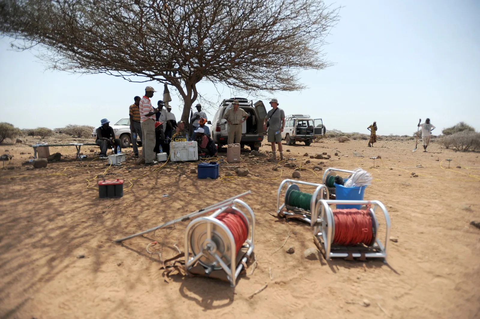
Cable reels and the meter for an electrical resistivity survey. The cables carry current to electrodes staked along a line, and the meter reads the voltage between other electrodes. (Photo: Petty Officer 1st Class Jonathan Kulp, U.S. Navy, public domain, via Wikimedia Commons · Public domain (US gov))

Geophysical Surveys for Construction Sites: GPR, Seismic Refraction and Resistivity, and What They Can't Tell You
A geophysical survey measures a physical property of the ground from the surface, such as how radar pulses reflect, how fast seismic waves travel or how easily electric current flows, and turns it into a picture of what's underneath. On a building site it fills the gaps between borings, finds buried utilities and objects, maps depth to rock and measures the shear-wave velocity that sets seismic site class. It works alongside borings, showing where to drill them and what lies between them.
What is a geophysical survey on a construction site?
A boring shows exactly what's in one hole. A geophysical survey covers a line or an area but measures a property of the ground. Radar responds to changes in electrical properties. Seismic methods respond to stiffness. Resistivity responds mostly to water in the pores. None of them returns "fat clay, very stiff" or "weathered limestone". That label only comes from a sample, so the survey has to be tied back to borings to mean anything.
The building code keeps borings in charge. Under 2021 IBC §1803.3, soil classification is based on observation and tests of material disclosed by borings, test pits or other subsurface exploration. Under §1803.3.1, a registered design professional decides the scope of the investigation: the number and types of borings or soundings, the in-situ tests and the lab program. A geophysical survey is one tool that design professional can add to the scope, next to the borings rather than in place of them.
Geophysical survey methods compared
| Method | What it measures | Common construction uses | Main limits |
|---|---|---|---|
| Ground-penetrating radar (GPR) | Reflections of a high-frequency radar pulse (EPA lists 40 to 1,500 MHz) from changes in dielectric properties | Utilities, tanks, voids under slabs, shallow layering, water table in sandy ground | EPA: penetration seldom exceeds 10 m; clay and conductive groundwater cut it sharply |
| Seismic refraction | Travel times of compression (P) or shear (S) waves refracted along layer boundaries | Depth to bedrock, layer thickness, approximate soil type by velocity | Works where layers get faster with depth; noisy sites near roads and rail are hard |
| Surface-wave methods (MASW, SASW) | Rayleigh wave dispersion, inverted to a shear-wave velocity (Vs) profile | Vs profiles for seismic site class, stiffness changes, soft zones | Gives a 1D profile per record; needs space for the receiver line |
| Electrical resistivity | Voltage between electrodes while current flows between two others | Rock depth, wet or disturbed zones, fill, landslide and seepage studies | Resistivity follows pore water, so values can't be read directly as soil type |
Ground-penetrating radar
GPR sends a short radar pulse into the ground. Soil horizons, the water table, rock surfaces and buried objects reflect part of it back, and the time it takes sets the depth. The EPA's environmental geophysics guide says resolution is very good because the wavelengths are short, but attenuation is high and penetration seldom exceeds 10 meters. Clay with a high cation exchange capacity increases attenuation, and so does groundwater with dissolved salts.
GPR finds utilities that standard locators miss. Electromagnetic locating tools need a conductive line, so they struggle with plastic pipe or concrete storm and sanitary sewers. GPR responds to dielectric contrast instead, which makes it useful for exactly those lines.
Seismic refraction
A crew lays out a line of geophones and strikes a plate with a sledgehammer, or uses another source, at known distances. The first waves to arrive at distant geophones have traveled along a faster layer below. From the arrival times you get approximate depths to strata boundaries and to bedrock, and velocities that hint at the material.
Refraction has a built-in limit. EPA's seismic guide explains that critical refraction, the effect the method depends on, happens only where the lower layer is faster than the one above it. A soft layer under a stiff one doesn't refract, so a refraction survey can miss it. That's one more reason to have a boring on the line.
Surface-wave methods and shear-wave velocity
Surface-wave methods measure how the speed of Rayleigh waves changes with frequency and invert that into a shear-wave velocity profile. EPA notes that for most earth materials, with Poisson's ratios between 0.25 and 0.48, treating Rayleigh-wave velocity as shear-wave velocity causes less than a 10% error. The multichannel version, MASW, was developed at the Kansas Geological Survey. Its standard workflow builds 1D Vs profiles from each record and assembles them into 2D cross-sections.
Electrical resistivity
Resistivity surveys push current into the ground between two electrodes and measure the voltage between two others. EPA's guide is blunt about what the numbers mean. Soil and rock grains are essentially nonconductive, so resistivity is controlled mostly by the amount of pore water, its own resistivity and the arrangement of the pores. Values vary widely for any one soil or rock type and can't be read directly as lithology. Zones of distinctive resistivity can be tied to specific units using drill-hole data, and then the survey extends the investigation into areas with little or no data, which is where it pays off on a large site.
Why clay changes the choice of method
Many North Texas sites sit on expansive, high-plasticity clay, and that rules some methods in and others out.
GPR is the one most affected. Wikipedia's summary of the method gives a useful range: in dry sandy soils or massive dry rock, penetration can reach about 15 m (50 ft), but in moist or clay-laden soils it may be as little as a few centimeters. On a clay site GPR is still useful for shallow targets such as utilities, voids under a slab or the edge of old fill, but it won't map rock at pier depth.
Resistivity and seismic methods work in clay, with caveats. EPA notes that in fine-grained soils there may be no resistivity change at the water table, unlike coarse granular soils where it usually shows. Seismic methods need a quiet site, and stiff clay over softer material is the layer order refraction can't see.
Seismic site class: where measured velocity can matter
Under 2021 IBC §1613.2.2, a site is classified as Site Class A through F under Chapter 20 of ASCE 7. When soil properties aren't known in enough detail to set the class, the code defaults to Site Class D, unless the building official or geotechnical data shows Site Class E or F soils. And where the investigation shows rock consistent with Site Class B but no site-specific velocity measurements are made, the site coefficients Fa and Fv are taken as 1.0.
Shear-wave velocity is one of the properties ASCE 7 Chapter 20 uses to classify a site. On projects where seismic design matters, a measured Vs profile from MASW or downhole testing can replace a conservative default with a measured class.
Utilities: where geophysics fits the quality levels
FHWA's Subsurface Utility Engineering program, built on ASCE/UESI/CI 38-22, sorts utility information into four quality levels:
| Quality level | Basis | Typical use |
|---|---|---|
| QL-D | Existing records or recollections only | Planning and route selection |
| QL-C | Survey of visible features (manholes, valve boxes) tied to records | Sites with few utilities |
| QL-B | Surface geophysical methods to find the existence and horizontal position of utilities, surveyed to project control ("designating") | Design decisions, such as where footings and storm lines go |
| QL-A | Nondestructive exposure, such as vacuum excavation, giving precise position, depth, size and material ("locating") | Points where conflicts are most likely |
QL-B is where GPR and electromagnetic locating do their work. FHWA notes that QL-B information lets designers place storm drainage, footings and foundations to avoid existing utilities. A geophysical locate for design doesn't replace the one-call notice required before anyone digs.
Site conditions that defeat a geophysical survey
EPA's list of warnings is worth reading before you order a survey. Methods become difficult or impossible where:
- the ground surface is concrete with rebar or wire mesh;
- dense urban or suburban utilities crowd the area;
- surface materials are highly conductive, which weakens electrical and electromagnetic signals;
- grounded electrical systems such as electric fences or cathodic protection are nearby;
- roads or railroads add seismic noise;
- asphalt or concrete paving needs extra work before electrical methods can be used;
- thick vegetation or limited access blocks the survey lines.
Questions to ask before ordering a geophysical survey
- What exactly are we looking for: rock depth, voids, utilities, a soft zone, fill limits, Vs for site class?
- Which method suits that target in this soil, and how deep can it realistically see here?
- Where will borings be drilled to calibrate the survey, and can the survey guide where they go?
- What site conditions (paving, fences, traffic, buried metal) could degrade the data?
- How will results be delivered: cross-sections, plan maps, a Vs profile, utility designations surveyed to project control?
- Who interprets the results alongside the soil boring logs and lab data, and how will they appear in the geotechnical report?
Talk to Isbell Engineering Consultants about subsurface exploration
Isbell Engineering Consultants lists geophysical surveys among its geotechnical engineering services: non-invasive subsurface exploration using techniques like GPR, seismic refraction or electrical resistivity. Its site investigation services cover soil sampling and testing, borehole drilling and test pits, and subsurface investigations and profiling. If you need to know what's under a site before you design on it, send the project details through our contact page.
Frequently asked questions
What is a geophysical survey?
A survey that measures a physical property of the ground, such as radar reflections, seismic wave velocity or electrical resistivity, from the surface, and uses it to map layers, rock, water and buried objects without digging.
What are the common geophysical survey methods for construction?
Ground-penetrating radar, seismic refraction, surface-wave methods such as MASW, and electrical resistivity. Electromagnetic locating is also widely used for utilities.
Can a geophysical survey replace soil borings?
No. The IBC bases soil classification on borings, test pits or other exploration, and geophysical results need borings to calibrate them. A survey reduces the guesswork between borings.
Does ground-penetrating radar work in clay?
Poorly at depth. Clay and conductive groundwater weaken the radar signal, so penetration in clay-laden soil can drop to a few centimeters. It still works for shallow targets in many cases.
What is the difference between a geotechnical and a geophysical survey?
A geotechnical investigation samples and tests the soil and rock directly through borings, test pits and lab work, then gives design recommendations. A geophysical survey measures physical properties from the surface and is often one part of that investigation.
Sources
- 2021 IBC Chapter 18, Soils and Foundations, §1803 Geotechnical Investigations (Texas, via UpCodes)
- 2021 IBC Chapter 16, Structural Design, §1613.2.2 Site Class Definitions (Texas, via UpCodes)
- US EPA, Environmental Geophysics: Ground-Penetrating Radar
- US EPA, Environmental Geophysics: Resistivity Methods
- US EPA, Environmental Geophysics: Surface Wave Methods
- US EPA, Environmental Geophysics: Seismic Methods
- US EPA, Environmental Geophysics: Warnings and Special Considerations
- Kansas Geological Survey, Introduction to MASW Acquisition and Processing
- FHWA, Subsurface Utility Engineering (quality levels, ASCE/UESI/CI 38-22)
- Wikipedia, Ground-penetrating radar
- Wikipedia, Seismic refraction
Image credits
- Reels of electrode cable and a resistivity meter laid out on bare ground for an electrical resistivity survey, with the field crew gathered by vehicles in the background. Photo: Petty Officer 1st Class Jonathan Kulp, U.S. Navy, public domain, via Wikimedia Commons · Public domain (US gov)
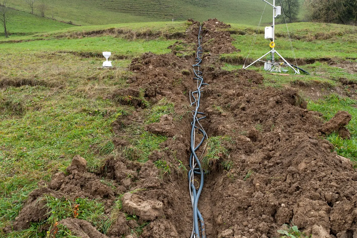
- A multi-core electrode cable laid in a shallow trench down a grassy slope for a permanent electrical resistivity tomography line on an active landslide. Photo: Ekrem Canli, CC BY-SA 3.0, via Wikimedia Commons · CC BY-SA 3.0 · resized

Related articles
Copyright © 2026 Isbell Engineering Consultants - All Rights Reserved.
Made & Managed by North Texas Business Solutions