
How to Use USDA Web Soil Survey to Screen a Texas Building Site, and Where It Stops
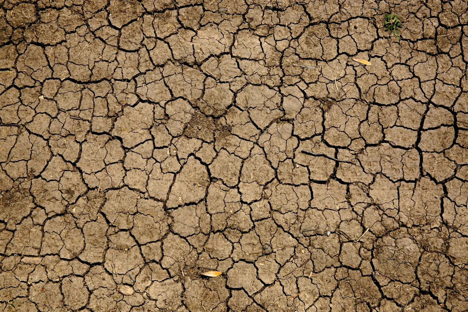
Deep desiccation cracks are a field sign of high shrink-swell clay, the kind of soil Web Soil Survey flags with a high linear extensibility rating. (Photo: Photo by Mike Erskine (@mikejerskine) on Unsplash · Unsplash License)
Web Soil Survey (WSS) is the USDA Natural Resources Conservation Service's free online soil map. For a building site, it's a quick way to see if you're dealing with high shrink-swell clay, shallow bedrock, a high water table or flooding before you spend money on anything else. It is not a geotechnical report, and the way NRCS describes its own data makes that clear.
Here's how to pull the ratings that matter for construction, how to read them, and where the tool stops being useful.
Step by step: getting engineering ratings out of Web Soil Survey
WSS works in four tabs. The NRCS help page describes them as defining an Area of Interest, viewing the Soil Map, exploring the Soil Data Explorer and using the Shopping Cart to get a report.
1. Define your Area of Interest (AOI). Open Web Soil Survey and start the app. Search by address or zoom to the site on the map, then use the AOI rectangle or polygon tool to outline the tract. NRCS limits drawn AOIs to 100,000 acres, far more than any building site needs. Draw the property line closely so the percentages reflect your site.
2. Read the Soil Map tab. You'll see the tract split into map units, each with a symbol and a name like "Houston Black clay, 1 to 3 percent slopes." The legend shows the acres and percentage of your AOI in each unit. Write these down. A tract that's 90% one clay unit is a different conversation from one split across three soils and a floodplain unit.
3. Open the Soil Data Explorer. The ratings useful for building sites are spread across a few areas:
- Suitabilities and Limitations for Use → Building Site Development. Ratings for dwellings without basements, small commercial buildings, local roads and streets, and shallow excavations.
- Soil Properties and Qualities → Soil Physical Properties → Linear Extensibility. This is the shrink-swell indicator.
- Soil Properties and Qualities → Soil Qualities and Features → Depth to Any Soil Restrictive Layer. Shallow rock or a dense layer.
- Water Features. Depth to water table, flooding frequency and ponding frequency.
- Soil Reports → Soil Physical Properties and Engineering Properties. Unified (USCS) classification, liquid limit and plasticity index ranges by depth.
4. Use the Shopping Cart. Add the map and the ratings you looked at, then generate the free Custom Soil Resource Report as a PDF. Attach it to your feasibility file.
How to read the results
| What you're looking at | What it tells you | How to use it |
|---|---|---|
| Linear extensibility | Shrink-swell potential. NRCS classes: low under 3%, moderate 3–6%, high 6–9%, very high over 9% | High or very high means expect expansive clay foundation design |
| Dwellings without basements / small commercial buildings | NRCS rating of how much the soil limits that use: not limited, somewhat limited, very limited | "Very limited" doesn't mean unbuildable; it means overcoming the limitation will cost more |
| Plasticity index range | How plastic the clay is | A PI of 15 or more is one of the IBC's expansive soil criteria |
| Depth to restrictive layer | Bedrock or a dense layer near the surface | Affects excavation, utility trenching and pier depth |
| Flooding frequency | How often the map unit floods, from soil evidence | A red flag to check against FEMA flood maps, not a substitute for them |
| Depth to water table | Seasonal high water | Affects excavations, basements and drilled pier construction |
Keep the interpretation assumptions in mind. NRCS rates "dwellings without basements" assuming single-family houses of three stories or less on spread footings about 2 feet deep (or at frost depth). That's a useful index, but a warehouse with column loads or a school on drilled piers is a different structure. Read the ratings as a signal about the soil, not as an answer for your building.
A Texas example: Houston Black clay
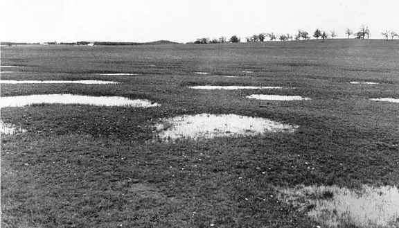
Run Web Soil Survey on a tract in the Texas Blackland Prairie and there's a good chance you'll see Houston Black clay or a related series. The NRCS official series description calls it a very deep, fine, smectitic clay that forms on uplands from calcareous mudstone. When dry, it cracks 1.25 to 10 cm wide and 30 cm or deeper. In undisturbed areas it shows gilgai, a hummocky micro-relief with knolls 8 to 46 cm higher than the depressions between them, caused by the soil's shrink-swell movement.
A WSS result like that tells you early that the building will need foundation design for expansive soil, that pavement subgrade will likely need treatment, and that drainage around the building matters. It doesn't tell you how deep the movement goes on your tract, what the clay's swell potential is under your slab, or what's at pier-bearing depth. Only borings and lab tests do that.
Where Web Soil Survey stops
NRCS is upfront about the limits:
- Map scale. Soil surveys are typically mapped at scales around 1:24,000. At that scale a map unit boundary on screen can be off by a meaningful distance on the ground, and small inclusions of different soil aren't shown separately.
- Not site-specific. NRCS states that soil survey data aren't designed for site-specific use, and that if intensive use of small areas is planned, onsite investigation is needed.
- Fill and disturbed ground. Urban and previously developed sites may have fill, cut or old foundations that the soil map doesn't reflect. Map units labeled "urban land" or "pits" tell you little.
- Depth. Soil surveys describe the soil profile near the surface. Pier bearing strata and deeper groundwater are generally outside what the survey covers.
- No design values. WSS doesn't give allowable bearing pressure, potential vertical rise, pier capacities or pavement design parameters.
The building code reflects this. The 2021 IBC (§1803) requires geotechnical investigations for buildings, with a narrow allowance for the building official to waive one where satisfactory data from adjacent areas show it isn't needed. A Web Soil Survey printout won't meet that requirement on a commercial project.
How Web Soil Survey fits into a project
| Stage | Tool | Purpose |
|---|---|---|
| Comparing sites | Web Soil Survey | Screen for clay, rock, flooding and water table |
| Under contract | Preliminary geotechnical investigation (a few borings) | Confirm soil conditions and likely foundation type |
| Design | Full geotechnical investigation | Foundation and pavement design parameters |
| Construction | Field observation and testing | Confirm conditions match the design |
Talk to Isbell Engineering Consultants about your site's soils
Isbell Engineering Consultants offers site investigations (soil sampling and testing, borehole drilling and test pits, subsurface profiling) and foundation recommendations through its geotechnical engineering services, and site feasibility and due diligence through its civil engineering services. If your Web Soil Survey report shows high shrink-swell clay or shallow rock and you need to know what that means for your building, contact us. Answers to common questions are on our FAQ page.
Frequently asked questions
What is Web Soil Survey?
Web Soil Survey is a free USDA NRCS website that provides soil maps and data for most of the United States. You draw an area of interest, view the mapped soils, look up properties and ratings, and download a custom soil report.
Is Web Soil Survey accurate enough for a building foundation?
No. It's mapped at a scale meant for planning and broad land use decisions, and NRCS says site-specific uses need an onsite investigation. Use it to screen a site, then get a geotechnical investigation with borings and lab tests for foundation design.
How do I find shrink-swell potential in Web Soil Survey?
In the Soil Data Explorer, go to Soil Properties and Qualities, then Soil Physical Properties, and select Linear Extensibility. NRCS classes shrink-swell potential as low below 3%, moderate from 3 to 6%, high from 6 to 9% and very high above 9%.
What does "very limited" mean in Web Soil Survey?
It means the soil has one or more features that are unfavorable for that use and that overcoming them generally takes major reclamation, special design or expensive installation. It doesn't mean the site can't be built on.
Is Web Soil Survey free?
Yes. Viewing maps, exploring data and downloading the custom soil resource report are free.
Sources
- USDA NRCS Web Soil Survey
- USDA NRCS Web Soil Survey Help
- USDA NRCS, Getting Started With Web Soil Survey
- USDA NRCS, Web Soil Survey Frequently Asked Questions (PDF)
- USDA NRCS, Soil Survey Manual (2017), Chapter 8
- USDA NRCS, National Soil Survey Handbook
- USDA NRCS Official Series Description, Houston Black series
- 2021 International Building Code, Chapter 18 (§1803 geotechnical investigations) as adopted in Texas (UpCodes)
Image credits
- Dry brown clay soil split into a network of deep shrinkage cracks. Photo: Photo by Mike Erskine (@mikejerskine) on Unsplash · Unsplash License
- Black-and-white photo of gilgai micro-relief in Texas, with water standing in shallow depressions across a grassy field. Photo: USDA Natural Resources Conservation Service, via Wikimedia Commons · Public domain (US gov)

Related articles
Copyright © 2026 Isbell Engineering Consultants - All Rights Reserved.
Made & Managed by North Texas Business Solutions