
Grading Plan: What a Civil Engineer Shows and Why Finished Floor Elevation Matters
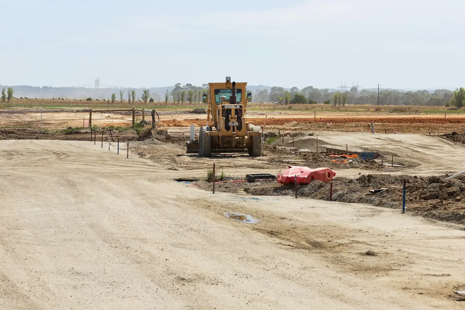
A motor grader shaping a development site to the elevations on the grading plan. (Photo: Photo by Troy Mortier (@troyscanon) on Unsplash · Unsplash License)
A grading plan is the drawing that sets the finished shape of a site: the proposed ground surface, the floor elevations of the buildings, the slopes of the pavement and the path every bit of runoff takes to an inlet, a swale or a pond. Building officials review it to make sure water moves away from buildings and doesn't get dumped on the neighbors. Contractors build from it. If it's wrong, the first heavy rain shows you where.
This guide explains what a grading plan shows, how to read it, and the numbers behind it on a Texas commercial site.
What a grading plan shows
A typical commercial grading plan includes:
- Existing contours (usually dashed) from the topographic survey.
- Proposed contours (usually solid) showing the finished surface.
- Spot elevations at building corners, curb returns, inlets, high and low points and grade breaks.
- Finished floor elevation (FFE) for each building.
- Slope arrows with percentages on pavement, sidewalks and swales.
- Drainage features: swales, inlets, storm pipes, flumes, outfalls and detention areas.
- Retaining walls with top and bottom of wall elevations.
- Limits of grading and, on many sets, a separate erosion control sheet.
The drainage plan and grading plan are often combined on one sheet for small sites and split on larger ones, with drainage area maps and pipe calculations in the drainage plan.
How to read a grading plan: common symbols and labels
| Label or symbol | What it means | What to check |
|---|---|---|
| Dashed contour with elevation | Existing ground | Compare with proposed to see cut and fill |
| Solid contour with elevation | Proposed finished ground | Closely spaced lines mean steeper slopes |
| Spot elevation (e.g. "+612.45") | Exact finished elevation at that point | Spot elevations control over contours when they differ |
| TC / BC | Top of curb / bottom of curb (gutter) | Curb height = TC minus BC |
| FL | Flow line, the lowest point of a gutter, swale or pipe | Must slope continuously to an inlet or outlet |
| FFE or FF | Finished floor elevation | Should sit above the surrounding finished grade |
| HP / LP | High point / low point | Every low point needs an inlet or a way out |
| GB | Grade break | Where the slope changes |
| Arrow with "2.0%" | Direction and steepness of slope | Points downhill |
| TW / BW | Top and bottom of retaining wall | Wall height and whether the wall needs engineering |
Water flows perpendicular to contour lines, from higher to lower. Trace a raindrop from the roof downspout to the property line. If you can't follow it, neither can the water.
Finished floor elevation: the number everything else hangs on
The FFE is usually set first, because it drives everything around the building. Three things push it up or down:
Slope away from the building. The 2021 International Building Code (§1804.4) requires the ground immediately next to a foundation to slope away at not less than 1 unit vertical in 20 horizontal (5%) for at least 10 feet. Where lot lines, walls or other obstructions prevent that, swales at least 2% are allowed, and impervious surfaces within 10 feet of the building can slope at 2%. A floor set too low can't achieve those slopes.
Floodplain. If the site is in a mapped Special Flood Hazard Area, the community's floodplain rules apply. Under the federal NFIP minimum (44 CFR §60.3), in flood zones with a base flood elevation, new residential construction must have the lowest floor at or above that elevation, and new non-residential construction must either be elevated to that level or be floodproofed. Local ordinances can be stricter and may require freeboard above the base flood elevation, so check with the floodplain administrator.
Utilities. A gravity sewer service has to fall from the building to the main. If the main is shallow, the FFE may need to come up.
On North Texas clay, the slope-away requirement is more than a code box to tick. Water ponding against a slab on expansive soil soaks the clay along one edge, and the clay swells there and not elsewhere. That uneven movement is a familiar cause of slab cracking. Good grading keeps soil moisture under and around the slab more uniform. (Our article on suspended foundations and plumbing covers another side of the same problem.)
Slopes reviewers check on commercial sites
| Area | Typical controlling requirement | Source |
|---|---|---|
| Ground next to buildings | 5% for 10 ft, or 2% swales and impervious surfaces | IBC 2021 §1804.4 |
| Accessible parking spaces and access aisles | Slopes not steeper than 1:48 (about 2.08%) in any direction | 2010 ADA Standards §502.4; Texas projects are also reviewed under the Texas Accessibility Standards (TAS), so confirm the applicable limits |
| Accessible routes | Running slope not steeper than 1:20 (5%) unless designed as a ramp; cross slope not steeper than 1:48 | 2010 ADA Standards §403.3 |
| Pavement, swales and channels | Set by local drainage criteria for minimum flow and maximum velocity | City criteria manual (many North Texas cities use NCTCOG iSWM) |
The accessible parking limit is the one that trips up a lot of parking lot designs. A lot graded at 3% to drain quickly will fail an accessibility review at the accessible stalls.
Drainage, detention and the neighbors
A grading plan has to show that runoff leaves the site where it legally can. In most Texas cities that means conveying it to a public storm system, a natural channel or a detention pond, and not concentrating flow onto a neighbor's property in a way that didn't happen before. Many North Central Texas cities base their criteria on NCTCOG's integrated Stormwater Management (iSWM) manual, which covers hydrology, hydraulics and site development controls, but local versions differ. Detention requirements, pipe sizing and inlet spacing all come from the city's own manual.
Erosion control and construction stormwater
Grading disturbs soil, so the plan set usually includes an erosion control sheet showing silt fence, inlet protection, construction entrances and stabilization. In Texas, construction that disturbs one acre or more (or is part of a larger common plan) falls under TCEQ's construction general permit, TXR150000. Sites of 1 to less than 5 acres need a stormwater pollution prevention plan (SWP3); sites of 5 acres or more also file a notice of intent. EPA's federal rule uses the same one-acre threshold.
Common grading plan mistakes
| Mistake | What happens |
|---|---|
| FFE set before checking sewer depth | Building can't gravity-drain to the main |
| Low point with no inlet | Ponding at a door, a dock or an accessible stall |
| Spot elevations that don't match contours | Contractor builds the wrong surface; arguments in the field |
| Accessible stalls graded like the rest of the lot | Failed accessibility inspection, rework |
| Roof downspouts discharging at the foundation | Wet clay along one side of the slab |
| No allowance for topsoil and pavement section thickness | Finished grades end up high or low |
A quick review checklist for owners and contractors
- Can you trace water from every roof drain and every low point to an inlet or outfall?
- Does the ground slope away from every building face for 10 feet, or is there a swale?
- Are accessible stalls, aisles and routes inside their slope limits?
- Does the FFE work with the sewer, the street and any flood elevation?
- Do spot elevations, contours and the drainage plan agree?
- Is there an erosion control sheet, and does it match the phasing?
- Has the geotechnical engineer's guidance on pad preparation and drainage around foundations been carried into the plan?
Talk to Isbell Engineering Consultants about grading and drainage design
Isbell Engineering Consultants lists grading and drainage design among its civil engineering services, covering existing and proposed site grading; surface drainage, swales, inlets and storm drainage systems; and finished-floor and site elevation planning, along with stormwater management and detention design. Pad preparation and subgrade recommendations come from our geotechnical engineering services. If you need a permit-ready grading plan or a second look at one, contact us.
Frequently asked questions
What is a grading plan?
A grading plan is a civil engineering drawing showing the existing and proposed ground surface of a site with contours, spot elevations, building floor elevations, slopes and drainage features. It controls how the site is shaped and where stormwater goes.
Who prepares a grading plan?
On commercial projects a licensed civil engineer usually prepares and seals the grading plan, working from a topographic survey and the geotechnical report. Requirements vary by city, so check what your building department accepts.
How do you read a grading plan?
Start with the legend. Dashed contours are existing ground and solid contours are proposed. Spot elevations give exact heights at key points, and arrows show the slope direction and percentage. Water flows downhill perpendicular to the contours, so trace it from the building to an inlet or the property line.
What is the difference between a grading plan and a drainage plan?
The grading plan sets the finished surface and elevations. The drainage plan shows how runoff is collected and carried, with drainage areas, inlets, pipes, channels and calculations. On small sites they're often the same sheet.
How much should the ground slope away from a building?
The 2021 IBC requires at least 5% slope away from the foundation for 10 feet, or 2% for swales and impervious surfaces where 5% isn't possible. Local amendments and the geotechnical report can ask for more.
Sources
- 2021 International Building Code, Chapter 18 (§1804.4 Site grading) as adopted in Texas (UpCodes)
- 2010 ADA Standards for Accessible Design (§403.3 slope, §502.4 parking space slope)
- Texas Department of Licensing and Regulation, Texas Accessibility Standards
- 44 CFR §60.3, Flood plain management criteria (Cornell LII)
- NCTCOG iSWM Technical Manual
- TCEQ, Stormwater General Permit for Construction Activities (TXR150000)
- US EPA, Stormwater Discharges from Construction Activities
Image credits
- A motor grader shaping the subgrade on a flat development site with stakes and bare graded soil. Photo: Photo by Troy Mortier (@troyscanon) on Unsplash · Unsplash License
Related articles
Copyright © 2026 Isbell Engineering Consultants - All Rights Reserved.
Made & Managed by North Texas Business Solutions